 Meridian
Every Landscape
Has a Story.
Learn to Read It.
Real case studies. Exam-board mapped. Built for the student who wants to understand the world, not just pass the test.
No sign-up for the free lesson · Case study pack is free with email
Coastal Systems · England · AQA · Edexcel · OCR
The Holderness Coast
per year.
Europe's fastest eroding coastline — 61km from Flamborough Head to Spurn Point, losing approximately 2 million tonnes of material annually.
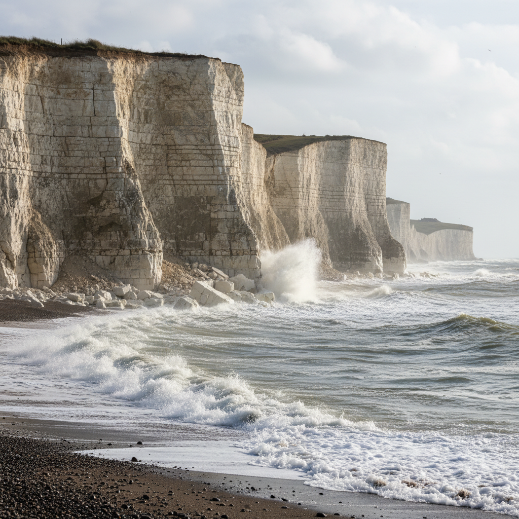
Since Roman times, approximately 5km of land has vanished — including 23 towns and villages. The underlying soft boulder clay, deposited during the last glaciation, erodes far faster than the chalk bedrock it covers.
This is not a distant hazard. Homes are falling into the sea. A road serving Mappleton village was 34 metres from the cliff edge before emergency defences were installed in 1991.
Destructive waves from the North-East carry a fetch of 500–800km across the North Sea, arriving with immense energy. The underlying Cretaceous chalk is largely buried beneath soft glacial boulder clay deposited 18,000 years ago — and it is this till that crumbles fastest. Sub-aerial erosion compounds the problem: rainwater infiltrates the clay, adding weight and triggering mass movement. The sea floor remains deep here, meaning waves lose little energy before impact.
Climate change link: Global temperatures have risen ~0.8°C over the past 150 years, with sea levels rising approximately 17cm. Accelerated sea level rise will intensify erosion rates, making current management strategies increasingly inadequate — a key evaluation point in exam answers.
Peel Back the Layers
Each place has a physical story and a human one. The exam wants both. So does Meridian.
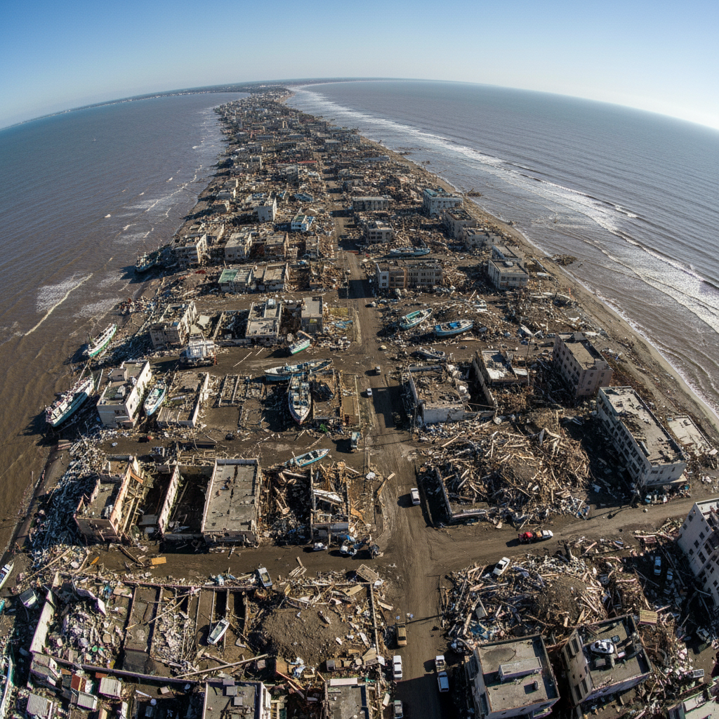
Indian Ocean · 26 Dec 2004
The Boxing Day Tsunami
A 9.1-magnitude earthquake ruptured 1,200km of the Sunda Trench. The Indian Plate subducting beneath the Sunda/Burman plates caused a 3-metre vertical seafloor displacement across a 400×100km area, generating waves up to 30 metres. The earthquake was so powerful it shortened Earth's day by 2.68 microseconds.
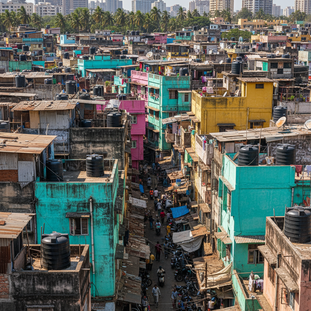
Mumbai, India · Est. 1884
Dharavi's Informal Economy
Founded in 1884 during British colonial rule, Dharavi grew through expulsion of factories from Mumbai's peninsular city centre and sustained rural-urban migration. Its population of approximately 1,000,000 occupies 2.39km², creating one of the world's highest population densities at 418,410 per km².
Built Around Your Specification
Whether you're sitting AQA Paper 1 next Thursday or building an IB IA, every resource is tagged to what you actually need.
AQA A-Level Geography
12 case studiesExam-Board Mapped
Every case study is tagged to the exact specification point. No hunting for relevance.
Real Places, Real Data
Primary statistics from USGS, NOAA, ONS, and UN sources — not textbook approximations.
Teacher-Projection Ready
High-resolution maps and diagrams formatted for classroom display. Download and go.
Updated for 2026
Climate data, erosion rates, and economic figures refreshed for current exam cycles.
From the Revision Desk
I used the Holderness case study the night before my Paper 1. The layer tabs made it so easy to revise physical processes separately from human impact — that's exactly how the exam questions split it.

Priya Mehta
A-Level Geography, St Paul's Girls' School, London · Predicted A*
I projected the Dharavi section in a Year 13 lesson on urban inequality. Students were immediately engaged — the $1 billion economy figure alone sparked a 20-minute discussion I hadn't planned for.

Mr. James Okafor
Head of Geography, Northampton Academy
I'd read about the Boxing Day Tsunami in three different textbooks and none of them mentioned the Earth's day shortening. That detail went straight into my personal statement.

Tom Whitfield
UCAS applicant · Geography, Durham University · Offer received
Download the
Case Study Pack
40+ case studies mapped to your exam board. PDF and print-ready. Includes Holderness, Boxing Day Tsunami, Dharavi, and 37 more.
Watch a Free
Lesson First
See exactly how Meridian teaches before you hand over your email. 18 minutes. Tectonic Hazards — why the 2004 tsunami death toll was so high.
Tectonic Hazards
18 min · Free · No account needed
The free lesson covers the same depth as the case study pack. If you don't find it useful, the pack won't be either. We'd rather you know that upfront.